From The Mana World
This special page shows all uploaded files.
| Date | Name | Thumbnail | Size | Description | Versions |
|---|---|---|---|---|---|
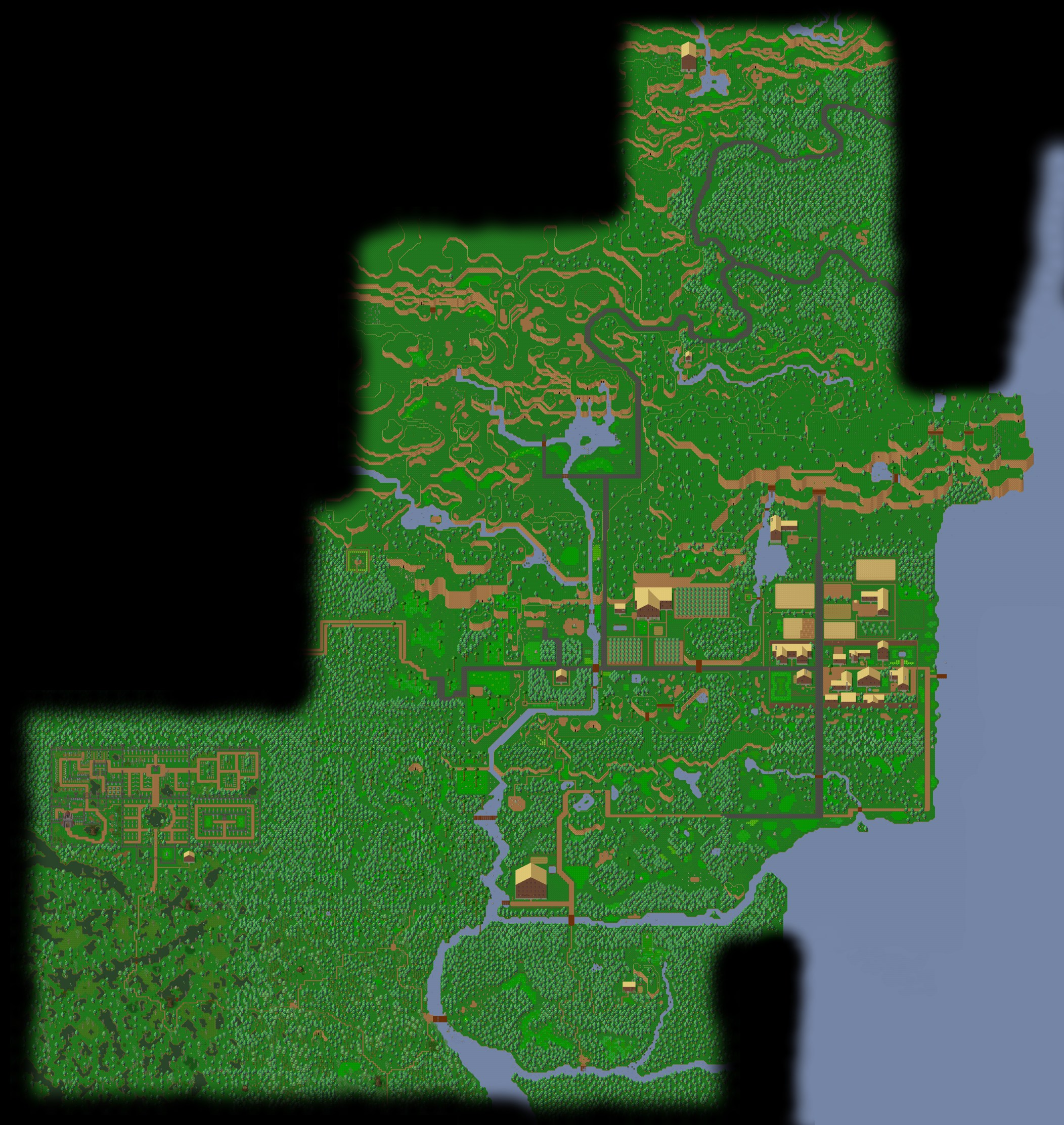
| 22:50, 6 January 2012 | WoodlandArea Map.jpg (file) |  |
1,000 KB | The current Woodland area map (1/8th scale). Fog has been added to hide undeveloped areas. An minor issue exists near 015-1 where trees did not match up, but this is in nonessential areas. | 1 |
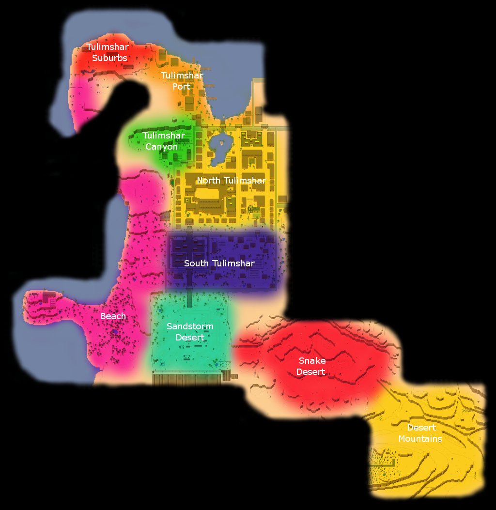
| 22:34, 6 January 2012 | DesertArea Labels.jpg (file) |  |
113 KB | A labelled and scaled version from an early edit of File:DesertArea_Map.jpg | 1 |
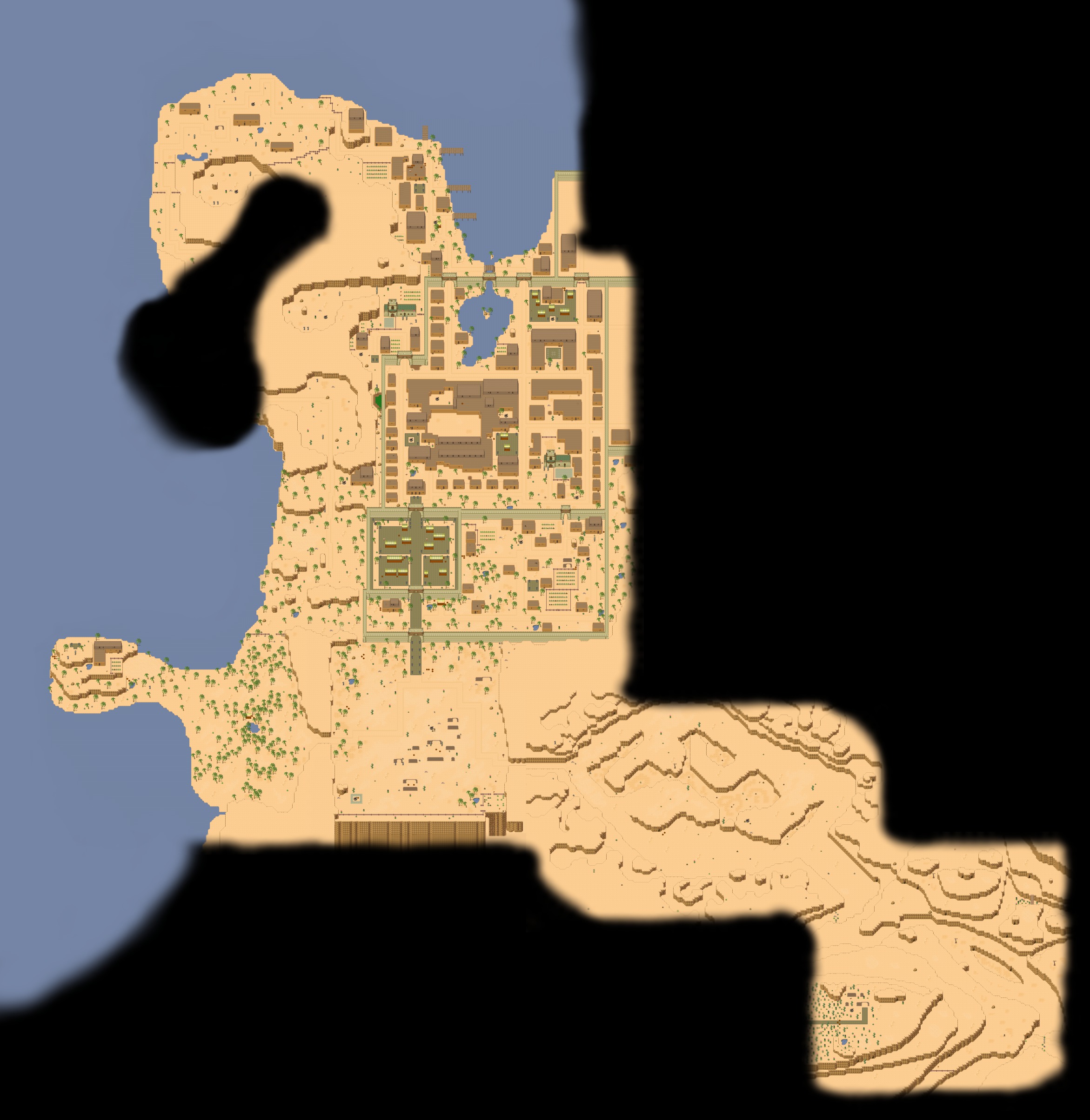
| 22:32, 6 January 2012 | DesertArea Map.jpg (file) |  |
589 KB | The current Desert area map (1/8th scale). Fog has been added to hide inconsistencies and undeveloped areas. (Note: only areas linked above-ground shown) | 1 |
| 21:08, 6 January 2012 | HurnscaldDowntown Labels.jpg (file) |  |
20 KB | Tile rendering used instead | 2 |
| 08:52, 6 January 2012 | Tulimshar Labels.jpg (file) |  |
31 KB | Use map based off of a tile image (actual game display) scaled down | 2 |
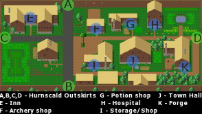
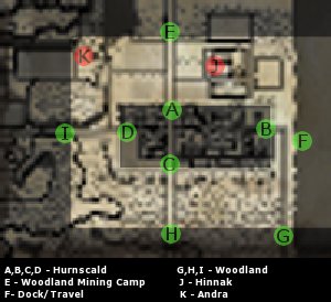
| 19:36, 4 January 2012 | HurnscaldOutskirts Labels.jpg (file) |  |
21 KB | A labeled map of Hurnscald Outskirts (region highlighted) | 1 |
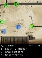
| 16:54, 4 January 2012 | Sandstorm Labels.jpg (file) |  |
8 KB | A labeled map of Sandstorm desert, for ease of quest/travel references. | 1 |
| 03:54, 4 January 2012 | TulimsharCanyon Labels.jpg (file) |  |
10 KB | A labelled map of Tulimshar Canyon | 1 |
| 03:31, 4 January 2012 | SouthTulimshar Labels.jpg (file) |  |
13 KB | Labelled map of South Tulimshar | 1 |
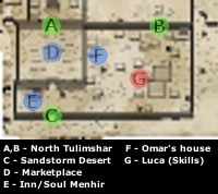
| 20:36, 3 January 2012 | NorthTulimshar Labels.jpg (file) |  |
15 KB | A map of North Tulimshar from the game with landmarks labelled. | 1 |